The single defensive wall of Minerve-la-Vieille can be seen from an altitude of 10 kilometers (if you know what to look for), and is possibly the biggest visible prehistoric structure in the south of France.
At 6 km. it looks like this, a white bar in the top left corner:
At 2 km. like this:
The visible section is about 60 metres long, 4 metres wide, and 2 m. high. It is a massive and dramatic example of an ‘ éperon barré‘ – literally a barred spur, a closed-off 5 hectare tip of a high ‘peninsular’ with sheer drops of 40 metres on the east and west flanks.
The term ‘oppidum’ might seem inappropriate – it more resembles ‘une enceinte fortifiée ‘ similar to that at Le Cros near Caunes, than the more compact Gallo-Roman structures like Pic St. Martin. There are no documents on the web to be found about it – just a couple of brief mentions:
M. J. Laurent-Mathieu Bulletin de la Société préhistorique française 1935 Volume 32
un camp celtique (oppidum) appelé « Minerve-la-Vieille », est délimité sur deux faces par un angle de la falaise à pic, et protégé sur sa troisième face, par un mur colossal en pierre sèche (long. 80 m. X haut. 2 m. X larg. 2m50).
It certainly is a ‘colossal wall’ – and placed in the midst of a wilderness of scrub, it’s one of the strangest places I’ve visited.
More photos and info on the Minerve-la-Vieille Page.
The word is derived from the early Latin ob-pedum: ‘enclosed space’, and possibly from the Proto-Indo-European ‘pedóm-‘ , an occupied space or footprint.
Julius Caesar described the larger Celtic Iron Age settlements he encountered in Gaul as oppida and the term is now used to describe the large pre-Roman towns that existed all across Western and Central Europe. Many oppida grew from hill forts but not all of them had defensive functions. The main features of the oppida are the architectural construction of the walls and gates, the spacious layout and commanding view of the surrounding area.
The development of oppida was a milestone in the urbanisation of the continent as they were the first large settlements north of the Mediterranean that could genuinely be described as towns. Caesar pointed out that each tribe of Gaul would have several oppida but that they were not all of equal importance, perhaps implying some form of hierarchy.
Hillforts, enclosures, defensive spurs, walls and ditches do not spring up in times of ease and peaceable neighborliness. It is during times of fear and uncertainty that massive effort is demanded of the local populace – producing, in our small area of the Aude, many significant ‘proto-castles’ during the transitional period Bronze final/ Premier Age de Fer.
The uncertainty must have started with the collapse of the Minoan civilisation, and again when vital trading links were lost with the end of the Mycenean empire. This Dark Age lasted for over three centuries. The fear? Rumours of a north-eastern race that were armed with new weapons and new skills: The Volques Tectosages and their Iron – the coming of the Celts.
Our local autocthones [native inhabitants] were the ‘peuples élisyques’ – a tribe centred on the Montlaurès hill-settlement, above the lagoons surrounding modern Narbonne – called by the Greek traders, Hélicé. South of here towards Spain were the Iberic tribes, and east towards Italy were the Ligurians. Herodotus of Halicarnassus writing in the 5th C BCE in his History [ Book 7 ch. 165] writes of a mercenary army made up of Phoenicians, Lybians, Iberians, Ligurians, Elysics, Sards [of Sardinia], and Cyrnians [Corsicans] – that is, all the tribes around the Gulf of Lion and the western Mediterranean.
For centuries preceeding the arrival of the Celts, the Elisycs ruled from Narbonne in the east to Carcassonne in the west. A short stretch of territory but an area that was rich in mineral wealth and full of cultural and historical wealth: the biggest dolmens, menhirs and necropoli in Languedoc. For millennia this land had been a benign and peaceable trading corridor : Pyrennean sheep herds in transhumance arriving from the South, Cornish tin and Irish silver in transit from the North, Cypriot copper and Greek wine in boats from the sea. All had to pass the marshy plain of the Atax/Attagus – the River Aude – between the foothills of the Montagnes Noires and the massif of Mont Alaric and the Corbieres Hills. All benefited from the mineral wealth – the gold and manganese – and the metallurgic skills of the local tribes. And from the peace and stability that had held since the Copper Age.
The breakdown of this civilisation led to the Dark Ages : the elaborately decorated pottery, the exchange of ornaments from afar, as evinced in funerary goods – gave way to a cruder and unadorned ceramic style, and to the rise of warrior classes and a heirarchy of power and protection.
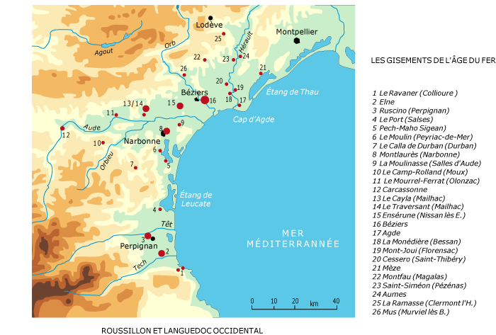
Thus a series of proto-castles were constructed around -800 by the Elisyan people, on promontories that allowed commanding views out over the plain and the road and river traffic, and security from attack by means of massive earth- and stone-works. From the oppida by the sea at Peyriac-de-Mer and Pech Maho in the east, past the the two vast settlements at Montlaurès and Ensérune, to La Moulinasse at Salles d’Aude, and on west inland to one of the greatest settlement-towns of the hinterland : La Cayla at Mailhac. And thence to Mourrel-Ferret at Olonzac, Camp Rolland here above our village of Moux, and onward to the Cros hill fort at Caulnes-Minervois and the Millegrand oppidum at Trebes – with Carsac at Carcassonne at the eastern limit. The pattern continues up towards the Atlantic coast – all defending and provisioning the vital trade route to the North.
It was however the Volques Tectosages themselves, centred on Toulouse, who took them over and re-established the trading-routes, ceding them eventually to the Romans – who made good use of some of them, while razing others to the ground.
There are six main oppida here in The Aude – follow the links in the Pages panel to the right. The Cros Hillfort and the Pic St-Martin hillfort have already been published there – the Roc Gris oppidum will be next, followed by the Mourrel-Ferrat oppidum. More to follow.
Quid is France’s Encyclopedia Britannica, on paper since 1967 and online since 1997. IGN is the Institute Géographique National – it began as an army mapping service in 1887 and went public in 1967. They are invaluable tools in researching old stones but they are not without weaknesses. This is what I found for Siran, a village nearby in the Minervois:
Cachette de fondeur de l’âge du Bronze à Centeilles. [Traces of Bronze Age smelting]
29 dolmens* et tumulus.
Habitat préhistorique à Centeilles, Ausine, Belvédère.
Champ des Morts.
Nécropole 1er âge du Fer à La Prade.
14 villas romaines, principalement : Najac, Saint-Michel de Montflaunez.
Oppidum du pic St-Martin occupé de l’âge du Fer au 6ème apr.J.-C.
Mosaïque gallo-romaine* à la chapelle de Centeilles.
Tombes wisigothiques à La Rouviole, Le Champ des Morts, Centeilles, Saint-Martin, Saint-Pierre des Troupeaux, Saint-Gontran.
And this is what the new IGN map says is there:
Centeilles seemed central to this rich and diverse little corner, and was one of the few from the list to be marked on the map, as was the Gallo-Roman fort [camp or oppidum] closeby. That confident red star looked a certain bet, so I set off this saturday to see what I could find – knowing that information on Quid could well be long out-of-date and that I could be beating around the bush all afternoon for nothing. But not suspecting that the map could get it so wrong.
The 13th.C. Chapelle de Notre-Dame-de-Centeilles was certainly there with its stone roof and holy well – as was a host of other fascinating structures and features [see following Posts & Pages] – and so were the remains of a massive emplacement deep in the wood where the map shows the red star. It wasn’t until I got home and compared this new map with the 1967 version that doubt set in about The Thing in the Wood. I now needed to persuade Jessi and Mary to come out on another hunt this sunday.
The story of this weekend’s two visits to Centeilles is complicated, so the photos about it all are over on the Pages section. Starting with the Not the Gallo-Roman Camp Page. And as fast as I can post them, the following will appear :-
The real Ancien Camp Gallo-Romain on the Pic St-Martin Hillfort Page.
The dolmen of Centeilles – or les Pierres Plantées, take your pick – on the Centeilles Dolmen Page.
The dolmen du Mourel des Fadas – on the Dolmen des Fadas Page.
The Chapelle de Notre-Dame de Centeilles – the extraordinary frescoes, its history, holy well and capitelles – on the Chapelle de Centeilles Page.
And the second earlier church at Centeilles [in many ways even more extraordinary] – on the Chapelle Ruinée Page. There was a third even earlier church here at one time – but it’s been lost . . .
And then there’s those Roman villas, and the visigoth necropoli, and the neolithic habitat here too, somewhere – but I need another visit or ten, for them.