Childhood interests can ignite life-long passions. For Jean Miquel de Barroubio, in the 1860’s, his long walk to and from school began a distinguished career as collector and researcher of the complex geology of our region. For Germain Sicard, at the same time, the hill above his family ‘domaine’ at Les Rivières, Félines-Minervois, must have been a similar playground, full of archaeologic wonders.
From the Bronze age hillfort of Le Cros at the western end, to the mediaeval castle of Ventajou at the east, the plateau of La Planette – which extends over an area of 400 hectares (3 km long by 1 km wide) – is filled with fascinating stone structures : 16 megalithic tombs, two burial mounds, ancient mines, marble quarries, a stone fort and a standing stone. It is also called La Matte, after an impressively restored farm on its southern lip.
Sicard reported on his finds, in a bulletin of S.E.S.A. in 1896. He had gone up there in 1891 with his good friend Capitaine Savin, who was more interested in the ‘étrange construction’ in the middle of the plateau:
Guy Rancoule, senior departmental archaeologist specialising in the Iron age, confirmed to me recently that this was indeed a military stronghold – but of much later construction. It’s strange – but it’s not an oppidum.
In the same bulletin, Sicard published his map of this extraordinary place:
It was this map, plus the report written by le Docteur Arnal in 1948 ‘Excursion sur les causses de Minerve’ that has lead me a merry chase. Over many visits I have only managed to find two of the dolmens, the one menhir, and the ‘oppidum’.
Bruno Marc has done much better: he found most of them back in 1996. Recently he has included a few scanned photos of some of them, on his site.
But then a week ago – out of the blue – I received a comment here on this site, and then detailed emails from another dolmen-hunter: Joel. And it was Joel and his precise GPS coordiates that enabled me to visit six dolmens up there, this last weekend – all in one day. I appreciate how many hours and days of laborious searching were needed. Joel’s discovery of these previously imprecisely-located sites has impressed me immensely – and when you go up there you too will realise how difficult it is to find anything in this extraordinarily-jumbled landscape.
Equally chaotic is the naming and numbering of each tomb. Sicard, Miquel, Arnal and Bruno have all given different names to the scattered dolmens. With GPS and by working strictly from West to East I am proposing a definitive placement that will be presented to la Société d’ Etudes Scientifiques de l’ Aude, as part of the first complete geolocalised Inventory of the megaliths of the Aude.
Over the next few weeks, each of the six dolmens I visited will be given their individual Page. And in the meantime, I might just get back up there to find all the others.
The single defensive wall of Minerve-la-Vieille can be seen from an altitude of 10 kilometers (if you know what to look for), and is possibly the biggest visible prehistoric structure in the south of France.
At 6 km. it looks like this, a white bar in the top left corner:
At 2 km. like this:
The visible section is about 60 metres long, 4 metres wide, and 2 m. high. It is a massive and dramatic example of an ‘ éperon barré‘ – literally a barred spur, a closed-off 5 hectare tip of a high ‘peninsular’ with sheer drops of 40 metres on the east and west flanks.
The term ‘oppidum’ might seem inappropriate – it more resembles ‘une enceinte fortifiée ‘ similar to that at Le Cros near Caunes, than the more compact Gallo-Roman structures like Pic St. Martin. There are no documents on the web to be found about it – just a couple of brief mentions:
M. J. Laurent-Mathieu Bulletin de la Société préhistorique française 1935 Volume 32
un camp celtique (oppidum) appelé « Minerve-la-Vieille », est délimité sur deux faces par un angle de la falaise à pic, et protégé sur sa troisième face, par un mur colossal en pierre sèche (long. 80 m. X haut. 2 m. X larg. 2m50).
It certainly is a ‘colossal wall’ – and placed in the midst of a wilderness of scrub, it’s one of the strangest places I’ve visited.
More photos and info on the Minerve-la-Vieille Page.
Almost unmarked – but still quite remarkable. It should have a name: so I shall call it the Affiac Oppidum.
The hill upon which sit the vestiges of the oppidum lies just to the east of Trausse-Minervois, and dominates the Aude river plain. An old secondary Roman road from Carcassonne to Béziers passes close to its foot. A sizeable clay-works dating back to pre-Roman times lies on this once-important thoroughfare.
The locating of this impressive structure involved the three tools I have at my disposal : time, luck and perseverance.
This is presumably the entrance, opening south.
More photos & info on the Affiac oppidum page, right.
The information given on Quid for the Oppidum du Pic St-Martin is accurate – while the new IGN Seies Bleu map – and the http://www.geoportail.fr placing – is out by nearly 2 km. Its position is 2. 39′ 54″ E, 43. 20′ 11″ N and it is a most impressive structure. The site was occupied continuously from the Iron Age through to the arrival of the Visigoths. The earliest inhabitants were possibly the Ibères or the Ligures, but more certainly the Volques Tectosages [ a Celtic tribe that put up a fierce resistance to the invading Romans, and who were themselves an invading force from Middle Europe – the name translates best as Land-hungry Wolves ].
The scree slope rises about 300 feet from here to the walls.
More photos and info on the Pic St-Martin Hillfort Page
Quid is France’s Encyclopedia Britannica, on paper since 1967 and online since 1997. IGN is the Institute Géographique National – it began as an army mapping service in 1887 and went public in 1967. They are invaluable tools in researching old stones but they are not without weaknesses. This is what I found for Siran, a village nearby in the Minervois:
Cachette de fondeur de l’âge du Bronze à Centeilles. [Traces of Bronze Age smelting]
29 dolmens* et tumulus.
Habitat préhistorique à Centeilles, Ausine, Belvédère.
Champ des Morts.
Nécropole 1er âge du Fer à La Prade.
14 villas romaines, principalement : Najac, Saint-Michel de Montflaunez.
Oppidum du pic St-Martin occupé de l’âge du Fer au 6ème apr.J.-C.
Mosaïque gallo-romaine* à la chapelle de Centeilles.
Tombes wisigothiques à La Rouviole, Le Champ des Morts, Centeilles, Saint-Martin, Saint-Pierre des Troupeaux, Saint-Gontran.
And this is what the new IGN map says is there:
Centeilles seemed central to this rich and diverse little corner, and was one of the few from the list to be marked on the map, as was the Gallo-Roman fort [camp or oppidum] closeby. That confident red star looked a certain bet, so I set off this saturday to see what I could find – knowing that information on Quid could well be long out-of-date and that I could be beating around the bush all afternoon for nothing. But not suspecting that the map could get it so wrong.
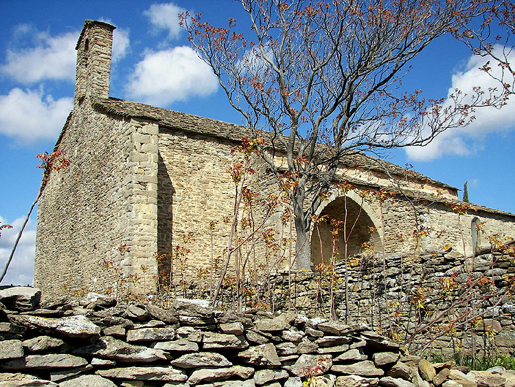
The 13th.C. Chapelle de Notre-Dame-de-Centeilles was certainly there with its stone roof and holy well – as was a host of other fascinating structures and features [see following Posts & Pages] – and so were the remains of a massive emplacement deep in the wood where the map shows the red star. It wasn’t until I got home and compared this new map with the 1967 version that doubt set in about The Thing in the Wood. I now needed to persuade Jessi and Mary to come out on another hunt this sunday.
The story of this weekend’s two visits to Centeilles is complicated, so the photos about it all are over on the Pages section. Starting with the Not the Gallo-Roman Camp Page. And as fast as I can post them, the following will appear :-
The real Ancien Camp Gallo-Romain on the Pic St-Martin Hillfort Page.
The dolmen of Centeilles – or les Pierres Plantées, take your pick – on the Centeilles Dolmen Page.
The dolmen du Mourel des Fadas – on the Dolmen des Fadas Page.
The Chapelle de Notre-Dame de Centeilles – the extraordinary frescoes, its history, holy well and capitelles – on the Chapelle de Centeilles Page.
And the second earlier church at Centeilles [in many ways even more extraordinary] – on the Chapelle Ruinée Page. There was a third even earlier church here at one time – but it’s been lost . . .
And then there’s those Roman villas, and the visigoth necropoli, and the neolithic habitat here too, somewhere – but I need another visit or ten, for them.